


Voting District 3199, Tarrant County, Texas
About
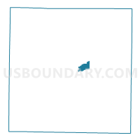
Outline

Summary
| Unique Area Identifier | 677071 |
| Name | Voting District 3199 |
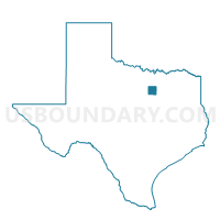
| County | Tarrant County |
| State | Texas |
| Area (square miles) | 3.38 |
| Land Area (square miles) | 3.20 |
| Water Area (square miles) | 0.17 |
| % of Land Area | 94.89 |
| % of Water Area | 5.11 |
| Latitude of the Internal Point | 32.78613520 |
| Longtitude of the Internal Point | -97.23039550 |
Maps

Graphs
Select a template below for downloading or customizing gragh for Voting District 3199, Tarrant County, Texas


Neighbors
Neighoring Voting District (by Name) Neighboring Voting District on the Map
- Voting District 1151, Tarrant County, TX
- Voting District 1227, Tarrant County, TX
- Voting District 1277, Tarrant County, TX
- Voting District 1460, Tarrant County, TX
- Voting District 3164, Tarrant County, TX
- Voting District 3176, Tarrant County, TX
- Voting District 3197, Tarrant County, TX
- Voting District 3406, Tarrant County, TX
- Voting District 3430, Tarrant County, TX
- Voting District 4042, Tarrant County, TX
- Voting District 4362, Tarrant County, TX
- Voting District 4418, Tarrant County, TX
- Voting District 4622, Tarrant County, TX
- Voting District 4632, Tarrant County, TX
Top 10 Neighboring County Subdivision (by Population) Neighboring County Subdivision on the Map
Top 10 Neighboring Place (by Population) Neighboring Place on the Map
- Fort Worth city, TX (741,206)
- Haltom City city, TX (42,409)
- Hurst city, TX (37,337)
- Richland Hills city, TX (7,801)
Top 10 Neighboring Unified School District (by Population) Neighboring Unified School District on the Map
- Fort Worth Independent School District, TX (466,910)
- Hurst-Euless-Bedford Independent School District, TX (137,578)
- Birdville Independent School District, TX (130,938)
Top 10 Neighboring State Legislative District Lower Chamber (by Population) Neighboring State Legislative District Lower Chamber on the Map
- State House District 91, TX (164,484)
- State House District 95, TX (155,511)
- State House District 92, TX (154,749)
Top 10 Neighboring State Legislative District Upper Chamber (by Population) Neighboring State Legislative District Upper Chamber on the Map
Top 10 Neighboring 111th Congressional District (by Population) Neighboring 111th Congressional District on the Map
Top 10 Neighboring Census Tract (by Population) Neighboring Census Tract on the Map
- Census Tract 1065.10, Tarrant County, TX (8,129)
- Census Tract 1065.11, Tarrant County, TX (6,634)
- Census Tract 1134.05, Tarrant County, TX (5,975)
- Census Tract 1133.02, Tarrant County, TX (4,060)
- Census Tract 1103.01, Tarrant County, TX (3,907)
- Census Tract 1065.15, Tarrant County, TX (3,824)
- Census Tract 1012.01, Tarrant County, TX (1,966)
- Census Tract 1065.07, Tarrant County, TX (1,900)
Top 10 Neighboring 5-Digit ZIP Code Tabulation Area (by Population) Neighboring 5-Digit ZIP Code Tabulation Area on the Map
- 76112, TX (38,993)
- 76117, TX (30,645)
- 76053, TX (28,421)
- 76120, TX (15,283)
- 76103, TX (14,572)
- 76118, TX (13,866)